

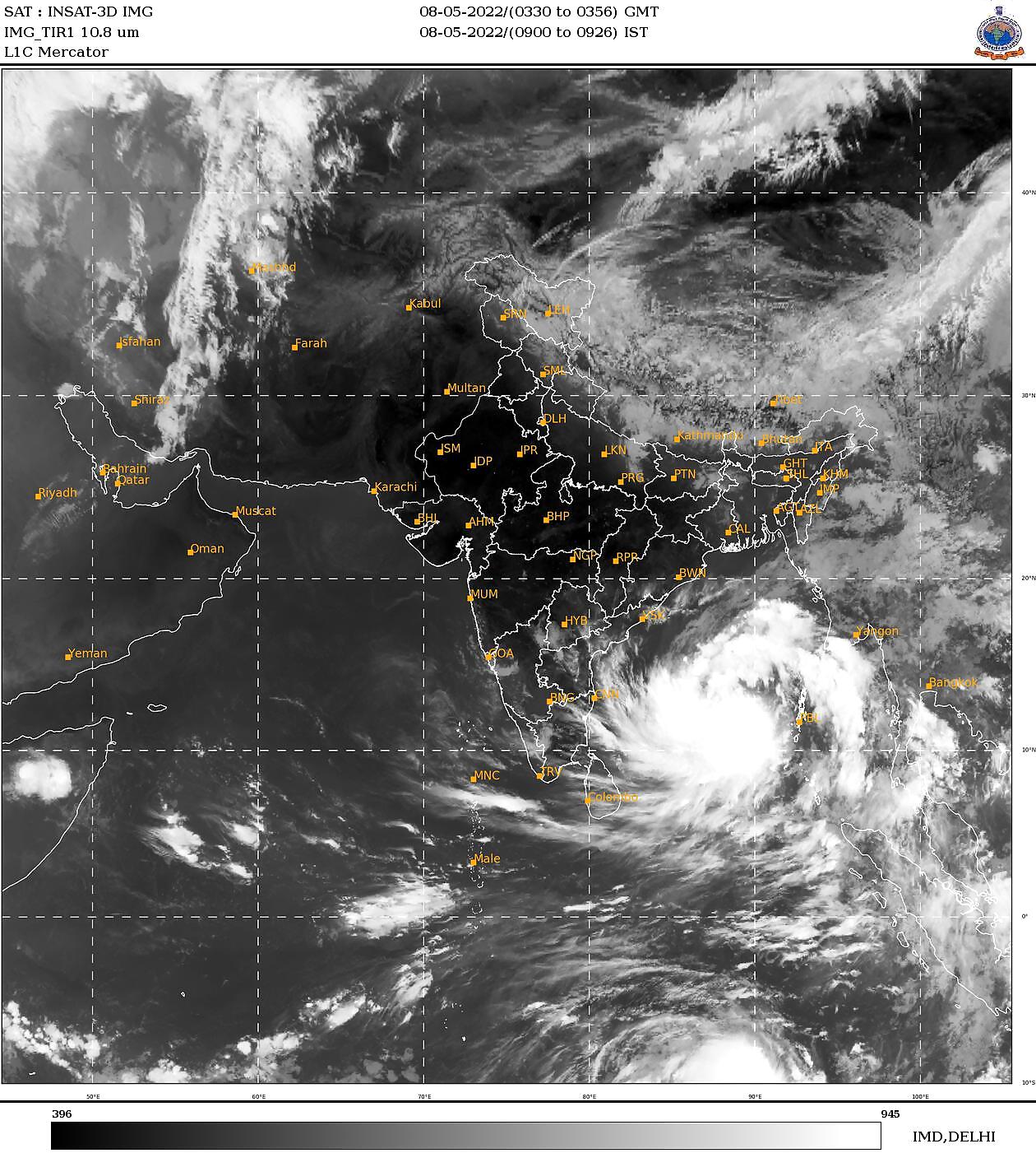
The rapidly intensifying cyclone Asani over east-central Bay of Bengal is likely to transform into a severe storm in the next 24 hours, said the India Meteorological Department (IMD).
The cyclone formed in the wee hours on Sunday was centred roughly 380 km away from Port Blair and 970 km southeast of Visakhapatnam at 5:30 am, and has continued to move north-westwards in the direction of the east coast over the last few hours. ‘Asani’ — a name suggested by Sri Lanka, which roughly translates to ‘wrath’.
According to meteorologists, it is expected to continue moving northwest towards north Andhra Pradesh till the evening of May 10 with a severe intensity, bringing winds 105-115 km/hour winds gusting up to 125km/hour over the sea. However, the latest forecasts suggest that it may not make a landfall over the east coast.
“Most of the numerical models are in good agreement that the system would intensify into a cyclonic storm by morning of May 8, and into a severe cyclonic storm over east central Bay of Bengal by evening. Most models indicate that the system would move northwestwards till May 10. It is likely to reach west-central and adjoining Northwest Bay of Bengal off the coast of North Andhra Pradesh and Odisha by Tuesday evening, and then recurve north-northeastwards and move towards northwest Bay of Bengal off Odisha coast,” said IMD.
While the coastal states may escape the wrath of the cyclone this time, it will certainly bring moderate to heavy rains and squally winds of 40-50 kmph gusting to 60 kmph over coastal Odisha and north Andhra Pradesh coast on May 10-11. The weather department has already sounded a fishermen warning, in view of the rough seas, and asked those in the sea to return immediately. According to meteorologists, the impact could be felt over north-eastern states, with fairly widespread heavy rainfall expected over Arunachal Pradesh, Assam-Meghalaya and Mizoram-Tripura during May 9-11.
The system was formed over south Andaman Sea on May 6, and the next morning it became well-marked and concentrated into a depression. It intensified rapidly and developed into a deep depression Saturday evening when it was found centred 1,140 km southeast of Visakhapatnam. By Sunday morning, it had gained strength to become a cyclone.
The sea surface temperatures of around 30-31 degree Celsius over the Bay of Bengal are fuelling the storm, which is further gaining strength from the favourable ocean-atmospheric conditions which are supporting its further intensification.
Read all the Latest India News here


Comments
0 comment