
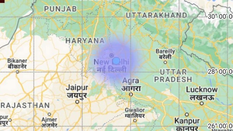
A 6.0 magnitude earthquake in Pakistan with its epicentre in the Hindu Kush region of neighbouring Afghanistan shook Delhi-NCR on Thursday. Tremors were not only felt in the national capital but also in parts of Jammu and Kashmir.
In Pakistan, tremors were felt in Islamabad, Lahore and its surrounding areas, and parts of Khyber Pakhtunkhwa province, as per DawnNews TV channel. Other cities that rocked after the jolts include Punjab’s Sargodha, Khushab and its surroundings, Mandi Bahauddin, Bhakkar, and Nowshera. The earthquake was also felt in Pakistan-occupied Kashmir’s Muzaffarabad, Geo News said.
Delhi-NCR is known to be an earthquake-prone area due to high seismic activity. It is unique in its placement that it trembles every three to four months as well as whenever there is an earthquake in the Himalayan region.
The region last felt a strong 6.4 magnitude earthquake, which struck Nepal at a depth of 10 km, early in November last year. Strong tremors were felt in Delhi after four earthquakes hit Nepal within an hour on October 3, 2023 and, then again, on October 16, when a 4.8 magnitude earthquake hit Nepal’s Sudurpaschim province.
But, what makes Delhi-NCR so tremor-prone in the first place? The answer lies within. India is located in a seismically active region. But with a lot of microearthquakes occurring every day, the stored-up energy gets released, as per director OP Mishra of the National Centre for Seismology, ministry of earth sciences.
Let’s look at why Delhi, most particularly, experiences frequent seismic activity:
What are earthquakes, how do they happen?
The most visual identifier of an earthquake is violent shaking of the ground and everything over it. When it comes to aftershocks felt in the region from a big earthquake, it can range from strong tremors to mild shaking for a short period of time.
According to the National Disaster Management Authority, an earthquake occurs without warning and results from the “release of accumulated stress of the moving lithospheric or crustal plates”. The earth’s crust is divided into seven major plates, which move slowly and continuously over its interior and several minor plates.
Earthquakes are tectonic in origin, which means that the moving plates are responsible for their occurrence and the shaking. An earthquake can claim lives in densely populated areas and cause large-scale destruction to public and private property. This is especially true for India, with its increasing population and rampant construction that puts the country at high risk.
It is not like India has not had its share of major earthquakes. The NDMA website states that in the last 15 years, the country has experienced 10 major earthquakes resulting in more than 20,000 deaths.
What does India’s seismic activity look like?
The NDMA states that more than 59 percent of India’s land area is “under threat of moderate to severe seismic hazard”. The entire Himalayan belt is considered prone to earthquakes of magnitude exceeding 8.0 and, in a relatively short span of about 50 years, four such earthquakes have occurred: 1897 Shillong (magnitude 8.7); 1905 Kangra (magnitude 8.0); 1934 Bihar-Nepal (magnitude 8.3); and 1950 Assam-Tibet (magnitude 8.6).
Experts have warned of the likelihood of the occurrence of “very severe” earthquakes in the Himalayan region. Regions away from the Himalayas and other inter-plate boundaries were considered to be relatively safe at one point of time but that has changed in the recent past.
It was the Koyna earthquake in 1967 that led to the seismic zoning map being revised. This resulted in the non-seismic zone being deleted from the map, while areas surrounding Koyna were also re-designated to Seismic Zone IV, indicating high hazard. The Killari earthquake in 1993 led to further revision in which the low hazard zone or Seismic Zone I was merged with Seismic Zone II, and some parts of Deccan and Peninsular India were brought under Seismic Zone III designated as moderate hazard areas.
Here is how India’s total landmass area is divided into earthquake seismic zones:
Zone V: 11% (most active)
Zone IV: 18%
Zone III: 30%
Zone II: 41% (least active)
Delhi in ‘high risk’ Zone IV of India’s seismic zoning map
The Himalayan range, which are young fold mountains, are located in the northern and northeastern region. It was the Indian plate’s movement towards the Nepalese plate that led to their formation. Hence, this entire region frequently experiences earthquakes due to its location on the boundary (fault zones) of two massive tectonic plates. The collision of these plates leaves both India and Nepal vulnerable.
Zone V of the seismic zoning map is the most active and at highest risk, including eight states and union territories. The Delhi-NCR region is in Zone IV, which is at ‘high risk’. Parts of Delhi and northern Uttar Pradesh fall in Zone IV while Gurugram lies on seven fault lines and, if these become active, they can cause a quake of a magnitude of 7.5.
So, for this region, earthquakes in the range of 4 to 4.5 magnitude are common. Delhi’s geographical location also makes it earthquake-prone as it lies on the foothills of the Himalayas.
In the last 100 years, 25 to 30 such earthquakes have happened in Delhi without significant damage. But, the capital is in such a position where it is not only affected by quakes in the Himalayan region but also has fault lines closer to it.
Delhi-NCR region has the following faults or weak zones:
- Delhi-Haridwar Ridge
- Mahendragarh-Dehradun Subsurface Fault
- Moradabad Fault
- Sohna Fault
- Great Boundary Fault
- Delhi-Sargodha Ridge
- Yamuna River Lineament
- Ganga River Lineament
- Jahazpur Thrust
According to media reports, experts said the hilly areas between Delhi and Udaipur through Gurugram, Jaipur and Ajmer have been witness to extensive geological activity, giving rise to these mountains and faults. But, they said many have healed now and become inactive.
What are faults? These are essentially cracks in the Earth’s crust. The joining point of tectonic plates is called a fault line and major earthquakes occur only along these. Energy is produced when the uneven and bumpy edges of a plate collide with each other. On collision, the edge separates from the fault and causes earthquakes.
Just like the Himalayas, the Delhi-Aravalli range was also formed through similar tectonic activity and they are much older. In the Delhi-Aravalli range, also known as the Aravalli-Delhi Fold Belt, ongoing tectonic activity may not create other geological forms but may cause minor earthquakes. Delhi is located between the Himalayas and the Aravalli-Delhi Fold Belt, which could be the reason behind frequent tremors.
Experts, however, pointed out that these quakes may be frequent but not ones to be worried about. In fact, those taking place in the Himalayas should be more of a source of concern since those can have adverse impact on towns and cities like Delhi.
(With PTI inputs)


Comments
0 comment