views
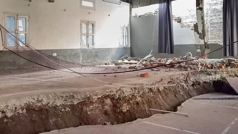
As Uttarakhand’s Joshimath continues to ‘sink’, the need for continuous seismic monitoring was discussed at the high-level review meeting of the Prime Minister’s Office (PMO) on land subsidence activities in the region. Officials stated that along with a detailed geotechnical investigation of the geological terrain in the Joshimath area, real-time seismic activity will also be monitored using seismic sensors.
What are seismic sensors?
Seismic sensors act as accelerometers or velocity sensors to detect earth vibrations. These sensors gather information about what is happening in a specific area.
They pick up on-ground vibrations and process the data instantly to notify operators. Seismic sensors may be able to identify whether the vibrations are coming from people or vehicles, as well as where they are coming from, depending on how sophisticated the system is.
The sensors are typically positioned 50 metres or so below the Earth’s surface. A central data processing centre receives data from all of these sensors. The data is then analysed by a central server to identify the source of the earthquake.
Continuous Seismic Monitoring
As per a research report, continuous seismic monitoring has enabled earthquake early warning (EEW) systems that send alerts to population centres and critical infrastructure seconds to tens of seconds before severe groundshaking occurs. Following the initiation of the rupture, a warning may be issued by analysing real-time recorded ground motions to assess the earthquake’s damage potential.
Researchers also claim that such sensors should be installed as close to the expected earthquake source as possible for the best warning times.
However, in the case of Joshimath, seismic monitoring, which utilizes sensitive seismographs, will help record ground motion caused by earthquakes or other sources of seismic waves.
The Joshimath Zone
Land subsidence, also known as the vertical downward movement of the Earth’s surface in an area with little to no horizontal movement, is causing the sinking panic in Joshimath. The cause of the phenomenon might be either natural or human-made.
According to the seismic zoning map of India, Joshimath is situated in the high-risk Seismic Zone 5— Very Severe Intensity Zone—at an elevation of more than 6,000 feet in the Uttarakhand’s Chamoli district.
Joshimath is not situated on the main rock, but rather on a deposit of sand and stone, and more specifically on an old landslide, according to the 1976 Mishra Committee report. At that time the committee also made some recommendations.
These include:
- Restrictions on heavy construction work, blasting or digging to remove boulders for road repairs and other construction
- Reduction in cutting trees and launching a campaign to plant more trees and grass
- Avoiding agriculture on slopes
- Not allowing the water to accumulate and drains be built to carry the water to a safer area.
Read all the Latest Explainers here


Comments
0 comment