
In a major move, India has decided to strengthen its satellite connectivity to one of the remotest places on Earth —Antarctica.
A Rs 110-crore project has been set in motion to commission a stronger satellite link between India’s two research stations in Antarctica and ISRO’s Shadnagar Centre in Telangana, separated by over 11,000 kilometres.
News18 has a copy of a tender issued by ISRO’s National Remote Sensing Centre in Hyderabad for the supply, installation, and commissioning of a Ka-band satellite link for Antarctica.
“This is a big move that will bring better connectivity and allow satellite internet services with high data transfer,” a top government official told News18.
This will be critical for the upcoming NISAR space mission led by scientists from India and the United States.
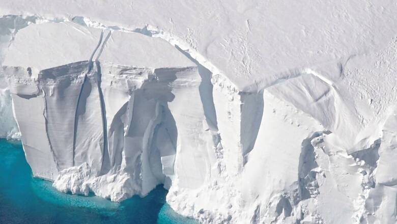
The NASA-ISRO Synthetic Aperture Radar (NISAR) to be launched in 2024 will collect voluminous data on how the ice sheets are changing down to fractions of an inch, and the rise in sea levels to understand the impact of global warming. The data could even exceed 80 terabytes a day.
Why Antarctica is important
ISRO and the National Remote Science Centre (NRSC) use India’s two ground stations in Antarctica, Maitri and Bharati, which are located near the south pole, to get satellite visibility for more orbits.
All the 14 to 15 orbits of Indian Earth Observation Satellites are acquired in real-time by these two ground stations and are transferred to Shadnagar in India through satellite and terrestrial networks.
The Shadnagar ground station can acquire remote-sensing satellite data only four times a day during ascending and descending orbits but all polar remote-sensing satellites including SCATSAT-1 rotate around the Earth 14 to 15 times per day. Hence, the Antarctic stations were set up.
India also sends about 50-100 scientists to the remote continent every year. However, communication remains a major challenge for the frigid land, as the current satellite network has limited bandwidth. To transfer that amount of data, India has been using conventional means.
“The size of the continent is huge, and it generates a multitude of scientific data that needs to be readily accessed. We also send about 80-100 of our scientists to Antarctica every year, but there is no proper data connectivity at present. The entire operations are managed from here, almost 11,000 kilometres away, relying on other satellite services which provide limited coverage and connectivity. Therefore, we need a stable connectivity just like we have it for the mainland,” says Dr Thamban Meloth, director of National Centre for Polar and Ocean Research (NCPOR), Goa. “There are so many climate observations being collected every year, which we are unable to handle due to lack of proper connectivity and bandwidth access. A lot of this is real-time data that needs to be analysed timely.”
Dr Meloth said people working in Antarctica also need to be connected to their families, as well as the outer world.
How step could help
The move could provide major support to research activities in the far-off land by helping in the timely transmission and processing of a multitude of science research data and operation files from the continent that remains isolated for at least six months of the year. As more network bandwidth becomes available, it will facilitate medical care through telemedicine to researchers.
The need for reliable and high-bandwidth communication services in the Antarctic is becoming increasingly evident. Scientists explain how most of the future scientific exploration of Antarctica will be done using satellite remote sensing to address challenges of data transfer faced by researchers. That is why various countries are discussing new opportunities for improved satellite communications in Antarctica.
The continent, which remains a no man’s land, is crucial because of its profound effect on the Earth’s climate and ocean systems. It now has more than 90 active research stations from 54 countries with at least a thousand researchers at any time of the year.
The submission of bids begins on May 26 and closes on September 22. A pre-bid meeting between NRSC and the prospective vendors interested in submitting proposals will be held at its office in Shadnagar on May 26. The entire mission will cost about Rs 110 crore.
ISRO established the Antarctica Ground Station for Earth Observation Satellites (AGEOS), at Bharati Station, Larsemann Hills, Antarctica, for receiving Indian Remote Sensing Satellite (IRS) data. This state-of-the-art advanced ground station was commissioned in August 2013 and is receiving data from IRS satellites (like CARTOSAT-2 Series, SCATSAT-1, RESOURCESAT-2/2A, CARTOSAT-1) and transfers this to NRSC, Shadnagar, near Hyderabad.


Comments
0 comment