
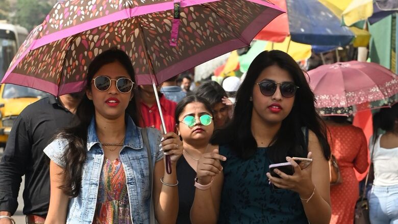
Signalling the start of a scorching summer, the MeT warned of a heatwave in several parts of the country beginning Thursday. This also includes parts of Bihar, Odisha, Gangetic West Bengal and coastal Andhra Pradesh, where the mercury has already crossed 40 degrees Celsius.
The temperature was hovering several degrees above normal in many parts of the western Himalayan region, including Delhi, where it touched 38.8 degrees Celsius on Wednesday. Maximum temperatures have already touched 42 degrees Celsius in Gangetic West Bengal, where the heatwave has started making an impact.
According to the latest forecast by the India Meteorological Department (IMD), temperatures will gradually rise over the next few days due to dry weather. The mercury is likely to remain three to five notches above normal over Northeast India, West Bengal as well as Sikkim, Odisha, coastal Andhra Pradesh, Kerala and Madhya Pradesh during the next four to five days. It will be one to three notches above normal over the rest of the country.
The weather department sounded a heatwave alert in isolated pockets over Gangetic West Bengal from April 13 to 17; over north coastal Andhra Pradesh and Odisha from April 13 to 15; and over Bihar from April 15 to 17. Temperatures are also gradually rising in Delhi and with clear skies, they could touch 40 degrees Celsius in the next few days.
Fresh western disturbance
The IMD further predicted that the weather is likely to be dry for Northwest India, including the national capital, at least till April 17; this will be followed by some rain activity as two fresh western disturbances are likely to impact the Himalayan region. While one system is likely to approach around April 15, another disturbance is expected between April 18 and 19, and could bring intermittent respite.
Western disturbances are storms originating from the Mediterranean Sea in the western hemisphere, which travel eastwards to India and bring precipitation like rain or snow upon impacting the Himalayas.
“The first system seems feeble and may bring light rain only in the upper reaches of the mountains – Jammu and Kashmir as well as Himachal (Pradesh). But we are expecting fairly light to moderate rain during the second one – around April 18 to 19. This should bring some respite from the heat to the northwestern plains as well,” said senior IMD scientist Surender Paul.
After the hottest February ever, the IMD’s summer outlook warned of an increased probability of heatwaves from April to June, with above-normal hot days over central India, eastern India and parts of northwestern states. April was predicted to be hotter, especially for eastern states like Bihar, Jharkhand, east Uttar Pradesh, Odisha as well as Gangetic West Bengal, along with Gujarat and Maharashtra, where the likelihood for rain was somewhat low.
Rajgarh in western Madhya Pradesh and Jharsuguda in Odisha recorded the country’s highest maximum temperature of 43 degrees Celsius on Wednesday. The highest maximum temperature for Northwest India was recorded at 42.2 degrees Celsius in Rajasthan’s Banswara.
Read all the Latest India News here


Comments
0 comment