views
It was the same question that had intrigued author Amitav Ghosh as he watched Hurricane Sandy hit the shores of the United States in 2012. Ghosh had written to Adam H. Sobel, a professor of atmospheric science at the Columbia University and the lead author of the study, and noted that 2015 was the first year in which the Arabian Sea was known to have generated more storms than the Bay of Bengal. In his book, The Great Derangement, Ghosh wrote, “This trend could tip the odds toward the recurrence of storms like those centuries past.”
Importantly, the study does not consider the effects of climate change. But notes that "increasing the proclivity of the Arabian Sea towards major cyclone activity". Sobel said, “It (climate change) may already have increased the risk beyond our estimates, as we considered all historical data together, whereas the risk may well already be elevated above the historical background.”
But how severe a cyclone, exactly? Sobel, who also authored the book, Storm Surge: Hurricane Sandy, Our Changing Climate, and Extreme Weather of the Past and Future told News18, “It depends how rare an event one wants to consider, but I think it’s reasonable to think about storms like the most intense ones that have made landfall in Gujarat in recent decades, such as the 1975 Porbandar cyclone or the 1998 cyclone. The latter killed thousands of people; if it had hit Mumbai the consequences would surely have been much, much worse.”
In 1977, GR Gupta, DK Mishra and BR Yadav of Meteorological Office in Delhi had written in the Indian Journal of Meteorology that it crossed the northern Gujarat coast near Porbandar at 3:30pm on October 22 and “showed rapid intensification during its formative stages and was singular for its track and severity”. At least 85 people died. The 1998 cyclone brought a large storm surge of 4.9 m (16 ft) which devastated coastal communities and, as per some estimates, led to nearly 10,000 deaths.
The study found that the return periods — the estimated average time being events — for wind speeds that return periods of winds exceeding 65 knots or 120 kilometers per hour at Mumbai were estimated to “be around 200 years” and “50–90 years within 150 km”. The return period for a storm with maximum wind speed of 100 knots (185 kilometers per hour) or greater “passing within 150 km of Mumbai (possibly close enough to generate a substantial storm surge at the city) is estimated to be around 500 years” and return periods that exceeded 100 knots (category 3 in the Saffir-Simspon scale) at Mumbai was estimated to be “in the range of thousands to greater than ten thousand years”.
Devastating and increasingly common as the impacts of climate change become more severe, scientists are increasingly worried that the intensity and frequency of cyclones will increase. This is where cyclone hazard models become important, as they are used to develop mitigation plans and strategies to reduce the impact of cyclones. Sobel explained, “Our model estimates the probability of a cyclone landfall of a given intensity. So its usefulness lies in that estimate of the hazard – that is, the component of the risk associated with the occurrence of the storm itself. In planning any response or mitigation measures one wants to know the likelihood of an event of a given severity, so that one can decide rationally how extreme an event to worry about.”
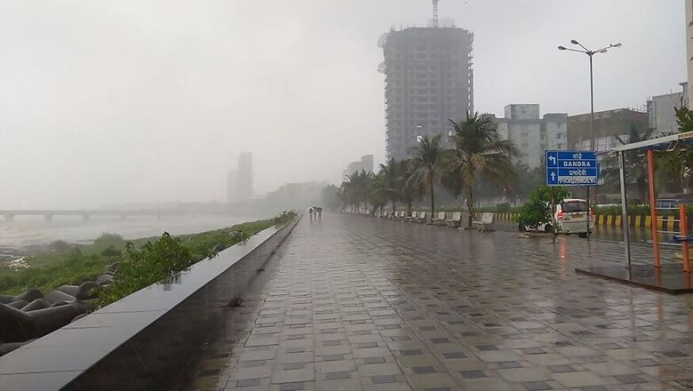
Ghosh, in his book, looks at Mumbai’s experience of the 2005 floods and asks readers to imagine what might, or might not happen if a major storm hits the city. While rendering the terrifying scope of devastation that might follow such a disaster, with 30-40 feet waves going through the city, he wrote, “In the case of a megacity like Mumbai this means that hundred of thousands, if not millions, will find themselves in harm’s way when a cyclone makes a landfall.”
Asked about the possibility of 30-40 feet waves entering the city, Sobel said, “Perhaps. The storm surge itself is the sustained elevation of the water level (i.e., it stays that high for hours); that was 9 feet in Hurricane Sandy in New York, and around 20 feet in Dorian in the Bahamas. Dorian was a stationary category 5 storm, which Mumbai is unlikely to get, but depending on the size of the storm 15 feet might be possible. Then waves on top of that might perhaps get as high as Amitav (Ghosh)’s estimate, though that would be an extreme event indeed.”
He added, “We do not, at this point, try to estimate the consequences of a storm of a given intensity – especially, storm surge flooding, which is probably the biggest concern for Mumbai. We are working on that, though we are limited by the fact that we don’t have good data on the city’s topography.”


Comments
0 comment