views
New Delhi: High alert has been sounded and National Disaster Response Force (NDRF) teams have been pre-positioned as severe cyclonic storm 'Vardah' will make a landfall between north Tamil Nadu and south Andra Pradesh on Monday.
The alert has been sounded across Andhra Pradesh, Tamil Nadu along the coast of Bay of Bengal, official sources said. One team of NDRF comprising around 40 personnel has been pre-positioned in Andhra Pradesh's Nellore, one in Tada, one in Salurupeta, one in Oongle, and one in Chitpore district.
At present Vardah is 390 Kilometres east of Nellore and 330 kilometers east of Chennai. It is moving with a speed of 20 kilometers per hour. While, some mandals in Nellore are expecting rainfall of 10-20 centimeters, some others are expecting rainfall of 6-10 centimeters. District administrations in the two states have made necessary arrangements.
In addition, another team is moving to Salurupeta while teams are on standby in Guntur and Hyderabad.
Three NDRF teams were pre-positioned in Chennai, two in Tamil Nadu's in Tiruvalur, one in Mahabalipuram.Sources said another team is on its way to Chennai while one team has been out on stand by at Arakkonam.
The Regional Meteorological Centre in Chennai said 'Vardah' lay centred at 330 km east of Chennai at 1430 hours on Sunday and would move westwards before making landfall between north Tamil Nadu and south Andhra Pradesh coasts tomorrow afternoon.
Under its impact, rains will start tonight and gradually increase tomorrow in the northern districts of Chennai, Tiruvallur and Kancheepuram, S Balachandran, Director, Area Cyclone Warning Centre, said.
On December 12, heavy to very heavy rains were likely in some places in these districts, he said, adding, strong winds could gust upto 80-90 kmph.
The sea would be rough, he said and asked fishermen to not to venture into the sea for the next 48 hours. Chief Minister O Panneerselvam held a meeting of the Tamil Nadu State Disaster Management Authority which also asked the armed forces to be on standby.
The Tamil Nadu government has also declared holiday for educational institutions in Chennai, Kancheepuram and Tiruvallur, besides coastal taluks of Villupuram.
Andhra Pradesh Chief Minister N Chandrababu Naidu reviewed the situation through a teleconference with Collectors and top officials this evening. He directed them to be alert and undertake necessary rescue and relief efforts in view of the cyclone threat.
Food and other essential commodities should be kept ready in adequate quantities, he said.
"Take all steps to prevent loss of lives and to minimise damages to crops and properties," Naidu told the officials.
ALSO READ: Eastern Naval Command Prepared for Cyclone 'Vardah'
Radar observations and satellite imagery indicated that Saturday's severe cyclonic storm, Vardah over west central and adjoining south Bay of Bengal moved West north-West wards and intensified into a severe cyclonic storm at 1800 UTC of 10th and lay near latitude 13.2N and longitude 86.4E, at about 660 Kilometres east of Chennai and it further moved westwards during past 6 hours with a speed of 13 Kilometres per hour and lay centred at 0300 UTC on December 11, 2016, over west central and adjoining southwest Bay of Bengal near latitude 13.
The cyclone is likely to cross North Tamil Nadu and South Andhra Pradesh coasts, close to Chennai as a Cyclonic Storm by December 12, 2016, afternoon. It may cause the following damages:
(i) Heavy Rainfall Warning: Rainfall at most places with isolated heavy to very heavy falls over south coastal Andhra Pradesh, north coastal Tamil Nadu and Puducherry is likely to commence for subsequent 36 hrs (from 11th December evening). The rainfall intensity will increase gradually becoming heavy to very heavy rainfall (7-19 cm) at a few places and isolated extremely heavy rainfall (= 20 cm) over Chennai, Thiruvallur and Kanchipuram districts of Tamil Nadu and Nellore and Prakasam districts of Andhra Pradesh on December 12, 2016.
(ii) Wind warning: Squally winds speed reaching 40-50 kmph gusting to 60 kmph would prevail along and off Andhra Pradesh and adjoining north Tamil Nadu coasts. It will gradually increase becoming 80-90 kmph gusting to 100 kmph during the time of landfall along and off Chennai, Thiruvallur and Kanchipuram districts of Tamil Nadu, Puducherry and Nellore and Prakasam districts of Andhra Pradesh.
(iii) Sea condition: Sea condition would be rough to very rough along and off Andhra Pradesh and north Tamil Nadu coasts. Sea condition along and off these coasts will become high to phenomenal from December 12 morning.
(iv) Storm surge: The tidal wave of about one meter height above the astronomical tide is likely to inundate the low lying areas of Chennai, Thiruvallur and Kanchipuram districts of Tamil Nadu and Nellore districts of Andhra Pradesh during the time of landfall.
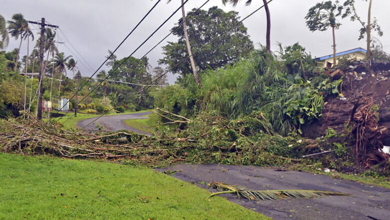
(v) Damage Expected: The storm will damage thatched huts, power and communication lines due to breaking of branches. It may cause major damage to Kutcha and minor damage to Pucca roads. Significant damage may be caused to paddy crops, banana, papaya trees and orchards over Chennai, Thiruvallur and Kanchipuram districts of Tamil Nadu; Ongole and Nellore districts of Andhra Pradesh and Puducherry.
(vi) Action Suggested: Fishermen are advised not to venture into sea along and off south Andhra Pradesh, north Tamil Nadu and Puducherry coasts.During next 48 Hours local forecast for Chennai city and neighbourhood: The sky condition is likely to be generally cloudy. Moderate rain will starts in the evening which gradually increase in time. Maximum and minimum temperature is likely to be around 29 and 21 degree Celsius respectively.


Comments
0 comment